
Hawaii Topographical Map
Static Hawaii Topo Map
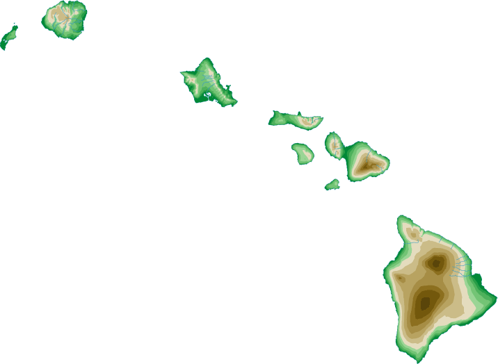
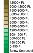
The Hawaiian island chain comprises the inhabited (Windward) islands in the southeast and the mostly uninhabited (Leeward) islands in the northwest. This section features a topographical map of Hawaii's inhabited southeastern islands as well as a map legend that specifies elevation ranges and indicates their corresponding map colors.
Map Legend |
 |
|
 |
Hawaii Topographical Features
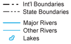
Hawaii's highest mountain is Mauna Kea, whose peak is 13,796 feet above sea level. Other notable mountains in Hawaii include Mauna Loa (13,680 feet) and Haleakala Crater (10,025 feet). Hawaii's lowest elevation is sea level, at the Pacific Ocean. Hawaii is an archipelago in the middle of the Pacific Ocean. These volcanic islands contain regions with mountains, deep ridges, and wide beaches. Major rivers in Hawaii include the Wailuku on Hawaii and Walmea and Hanalei on the island of Kauai.Interactive Hawaii Topo Map
This section features a topographical map that can be zoomed and panned to show the inhabited islands of the State of Hawaii or a small portion of these islands. To zoom in or out on the map, use the plus (+) button or the minus (-) button, respectively. To pan the map in any direction, simply swipe it or drag it in that direction. At high zoom levels, the contour lines on this Hawaii map can help outdoorsmen, land developers, and others to plan their routes and activities more efficiently.
Copyright © 2005-2024 State-Maps.org. All rights reserved.
Hawaii-Map.org is a State Maps reference source.
Hawaii-Map.org is a State Maps reference source.